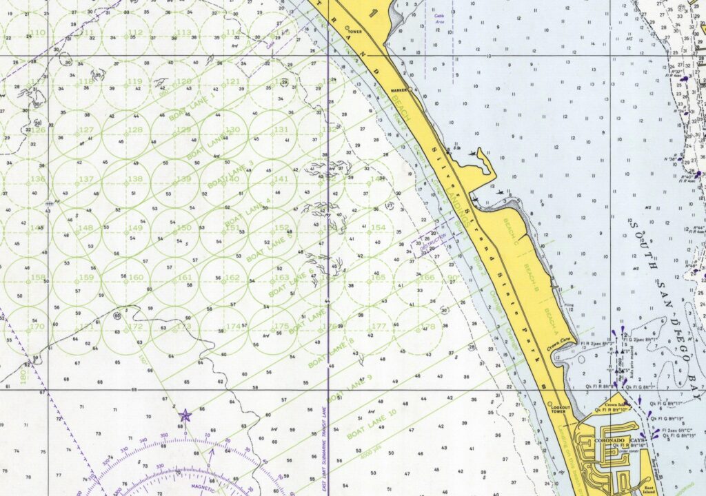
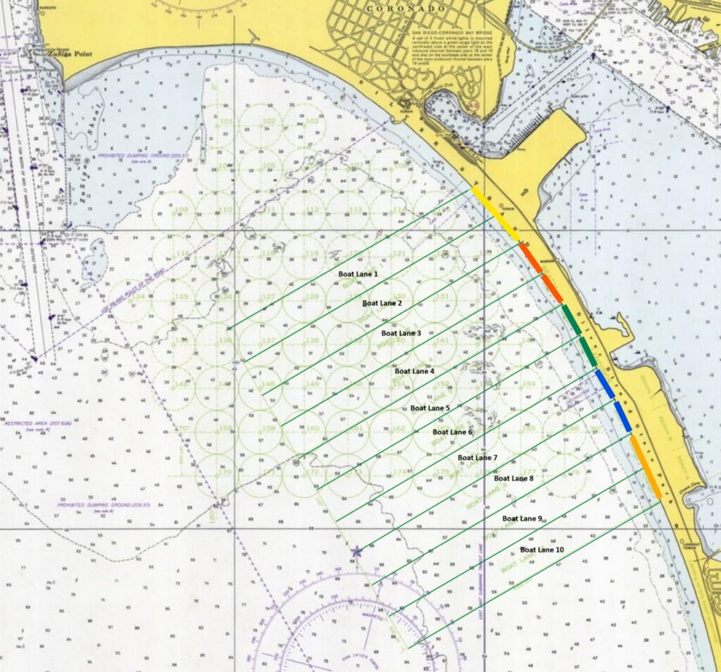
I found this 1974 chart of the San Diego Bay online at the NOAA historical map website. As you can see in the zoomed-in clip below, it shows beach lanes 1 to 10, and landing beaches (e.g., red 1, red 2).
Does anyone know if these beach lanes and landing beaches were organized in the same configuration and location in the 1950s and 1960s? If so I will be adding this detailed chart to the appropriate daily history research note documents between now and end of the year.
Thanks in advance for any information.

Original chart, above, showing beach lanes (light green lines), landing beaches, and mooring/anchorage locations (light green circles).

An annotated version of the same chart, highlighting the boat lanes and landing beach colors.
The full image of the chart can be accessed here: https://www.historicalcharts.noaa.gov/image.php?filename=5107-5-1974